Maps of Longyearbyen and the area around it
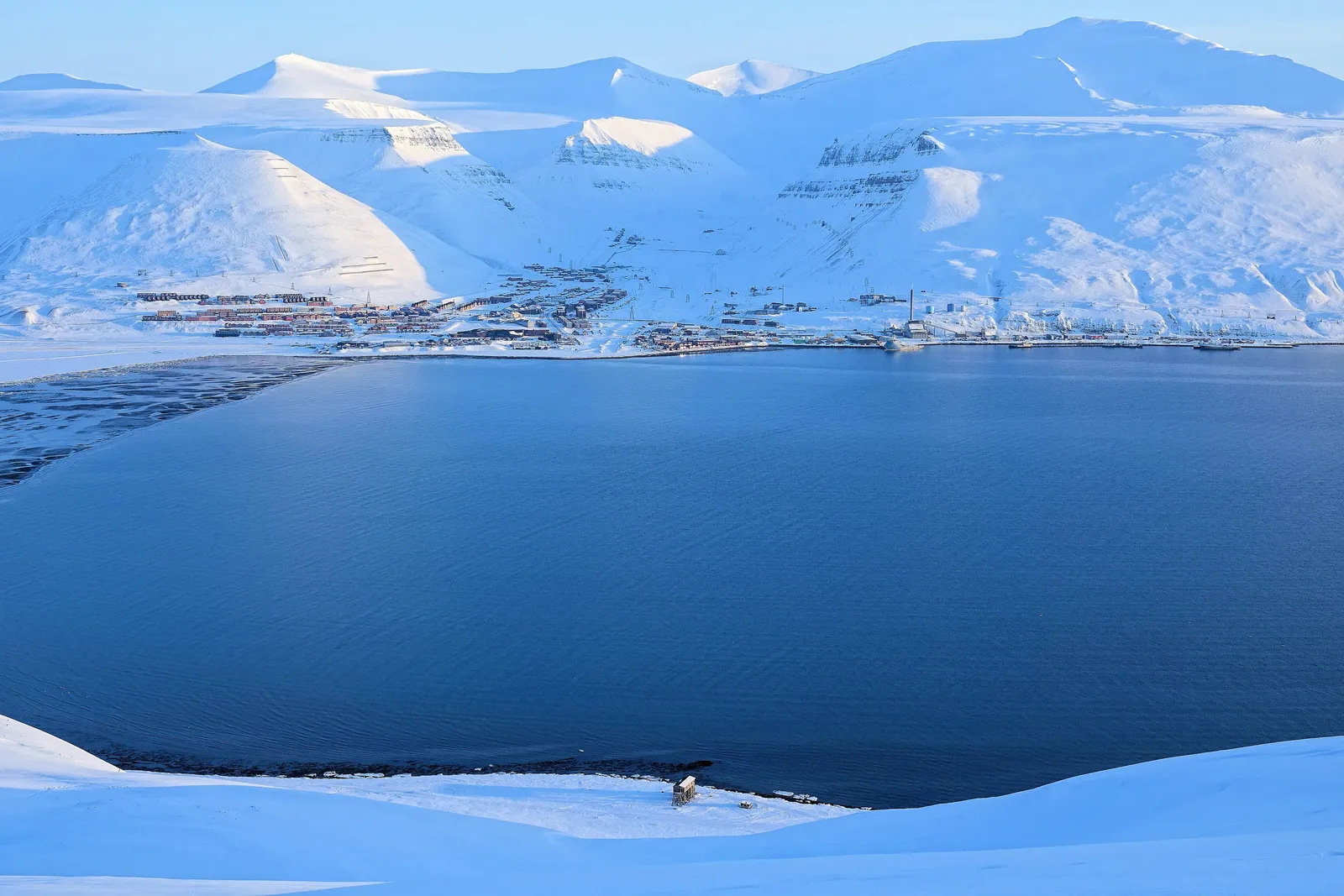

The maps on this page come from the Norwegian Polar Institute, which maps Svalbard and publishes its map data openly. They’re good for getting your bearings before you travel. For planning a trip in the field, use the institute’s interactive map, TopoSvalbard, described below.
Longyearbyen and Adventfjorden
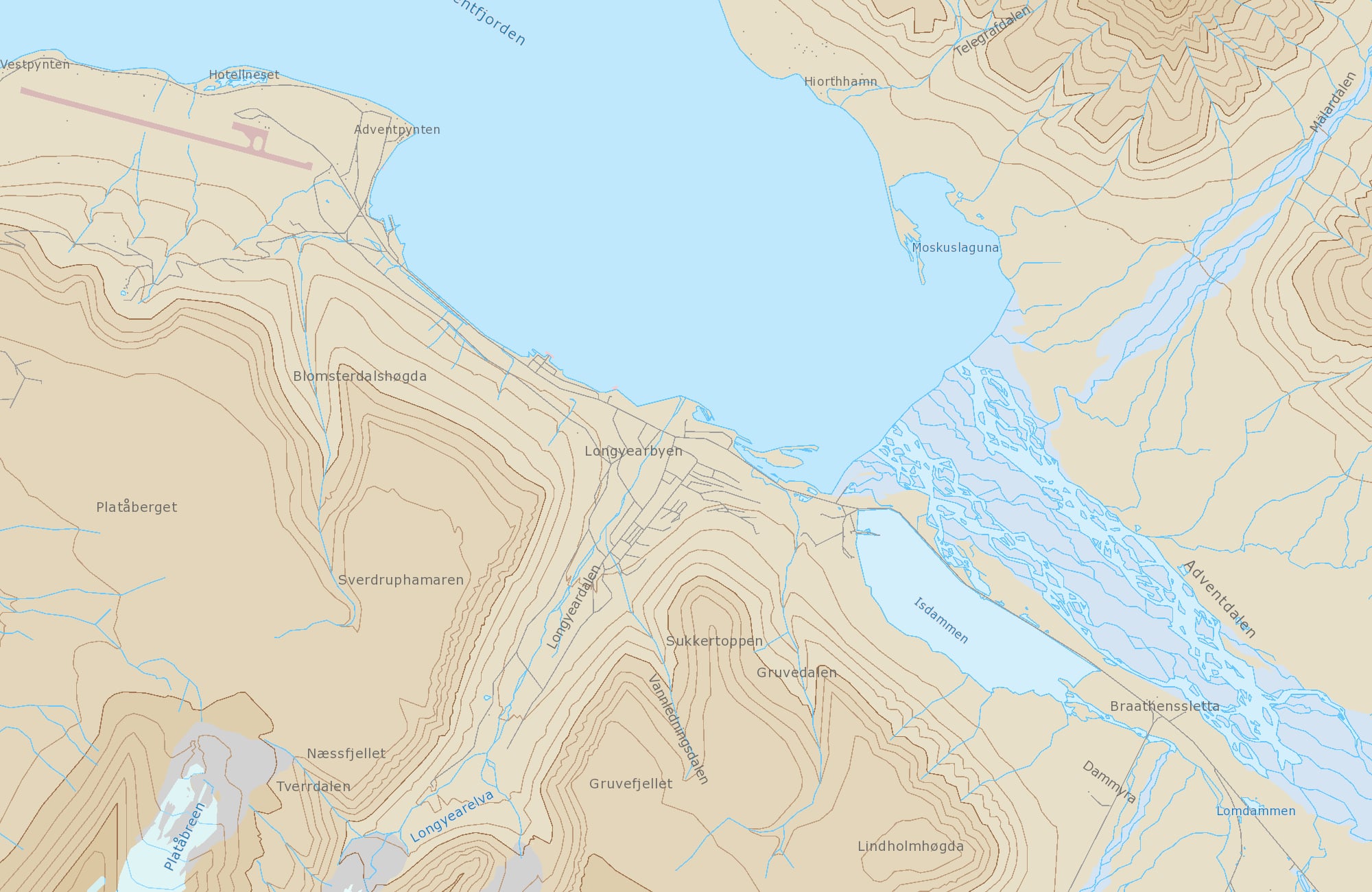
Things to look for on the map:
- The airport at Hotellneset, on the point to the west of town, with the runway along the shore.
- Longyearbyen itself, in the valley of Longyeardalen, with the river Longyearelva running down it. Nybyen sits at the top of the valley.
- Platåberget, the plateau west of town, where the satellite station is.
- Sukkertoppen and Gruvefjellet, the mountains rising straight up behind the houses.
- Isdammen, the lake east of town that is Longyearbyen’s drinking water reservoir. See the tap water story.
- Adventdalen, the wide valley with its braided river, where many guided trips head out of town.
- Hiorthhamn, the abandoned settlement across the fjord, a destination for kayak trips.
The wider area: Isfjorden and Adventdalen
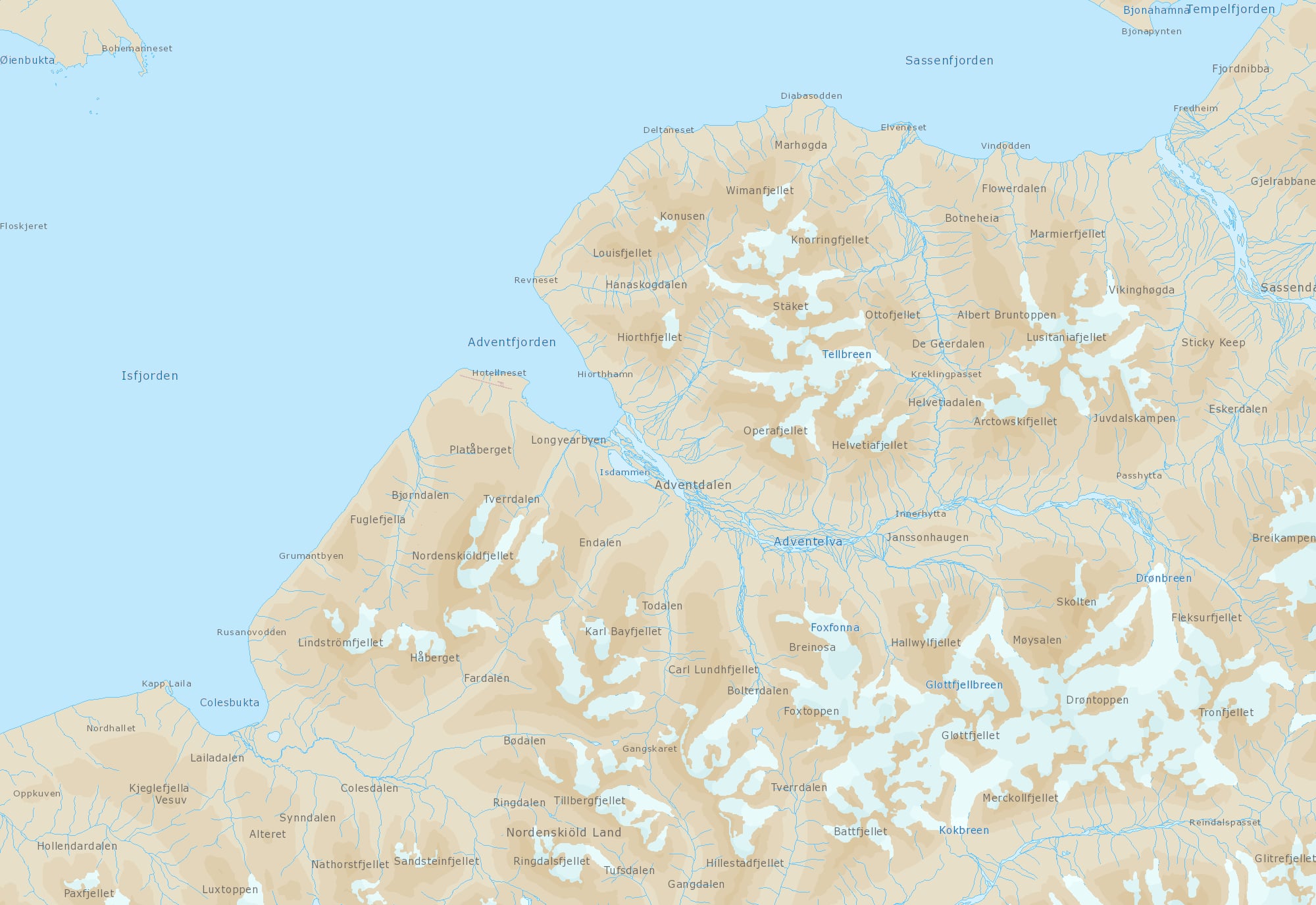
Longyearbyen sits on Adventfjorden, a side fjord of Isfjorden, the big fjord that cuts into the west coast of Spitsbergen. From town:
- Adventdalen runs inland to the east, the main route out of town in winter.
- Sassenfjorden and Tempelfjorden lie to the north-east. Tempelfjorden and its glaciers are a popular destination for snowmobile trips.
- Bjørndalen and the coast towards Colesbukta lie to the south-west.
Almost everything on this map is outside the town limits. Before you go there, read Polar bear safety: you need polar bear protection outside the settlements, and the simplest answer is to go with a guide. The maps don’t show where the town limits or the polar bear warning signs are.
Online maps
- TopoSvalbard, the Norwegian Polar Institute’s topographic map of Svalbard. It has maps, aerial and satellite images in summer and winter, nautical charts, place names and 3D views, and lets you measure distances and read coordinates. This is the one to use for planning.
- The Svalbard Map, the institute’s interactive thematic atlas, with environmental data. It also shows the boundaries of the areas where traffic is banned.
- Naturbase, Norway’s map of thematic nature data.
- Sea charts for Svalbard from the Norwegian Mapping Authority, if you’re on the water.
A town map
Visit Svalbard publishes a town map of Longyearbyen (PDF). It’s handy to keep on your phone, especially since Longyearbyen’s roads have numbers rather than names.
Map data you can download
The data behind TopoSvalbard and the Svalbard Map is largely available for download from the Norwegian Polar Institute’s geodata portal, licensed under CC BY 4.0, so you can use it in your own map app or GPS as long as you credit the institute.
Practical info
- Getting there
- The maps on this page cover Longyearbyen, Adventfjorden and Adventdalen. For anywhere else in Svalbard, use TopoSvalbard.
- Season
- TopoSvalbard has both summer and winter satellite images, which helps when planning trips on snow.
- Cost level
- low
- Booking tips
- Download the town map before you travel. Outside the town limits, travel with a guide, whatever map you carry.
Sources
- https://www.sysselmesteren.no/en/maps-and-gps/
- https://toposvalbard.npolar.no/
- https://geodata.npolar.no/documentation/
- https://geodata.npolar.no/arcgis/rest/services/Basisdata/NP_Basiskart_Svalbard_WMS/MapServer
- https://svalbardkartet.npolar.no/
- https://kart.naturbase.no/
- https://kartverket.no/en/at-sea/more-about-nautical-charts/seacharts-on-svalbard
- https://en.visitsvalbard.com/dbimgs/Bykart_VisitSvalbard_2021_nett.pdf
- https://www.sysselmesteren.no/en/travel-in-svalbard/